The CRAN version can be loaded as follows:
or the development version from GitHub:
remotes::install_github('serafinialessio/mapping')The European geographical aggregates nomenclature, called NUTS (Nomenclature des unités territoriales statistiques)) are the following:
| Function argument | Aggregates | Level |
|---|---|---|
| “nuts0” | European countries | level 0 |
| “nuts1” | European divisions for each country | level 1 |
| “nuts2” | European regions for each country | level 2 |
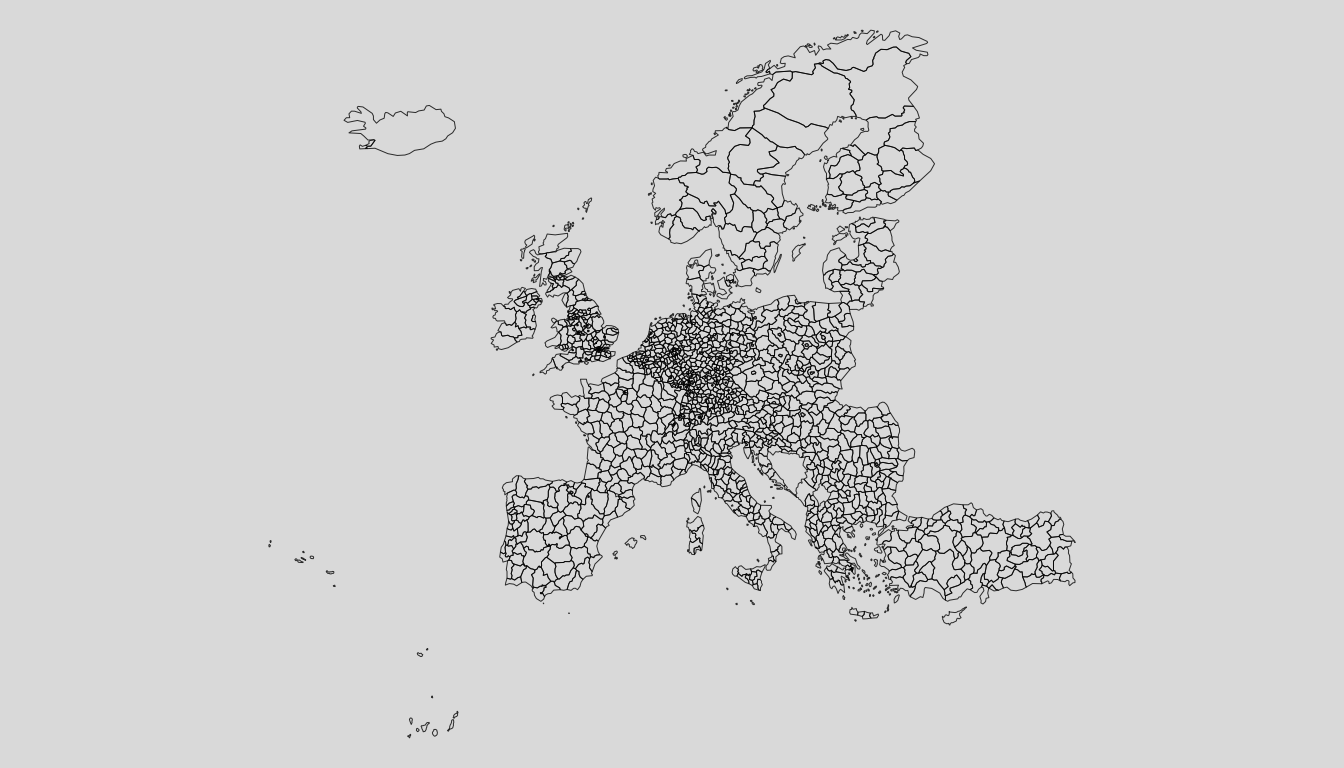
| “nuts3” | European municipalities for each country | level 3 |
where level 0 is the largest unit (country), and level 4 the smallest unit. In addition Urban Audit (“urau”) are also provided.
The diagram show the hierarchy used in the EU() to build
the object to map. Smaller aggregate/levels have all the information of
the bigger aggregates. For example, if we have “nuts2”, we have also all
the information until the country level, “nuts0”.
Level may have names expressed in different ways. The package provides:
| Names | Code |
|---|---|
| Nuts names | nuts |
| Nuts id code | id |
| iso2 coutry code | iso2 |
| iso3 country code | iso3 |
This can be specified in matchWith argument,depending on
the ids in the input data.
eu_level0 <- loadCoordEU(unit = "nuts0")
mappingEU(eu_level0)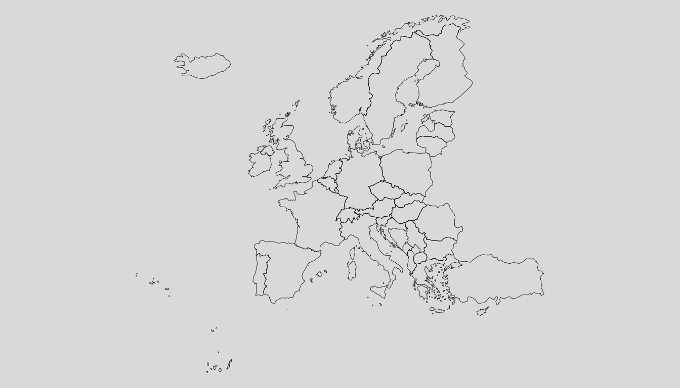
eu_level0 <- loadCoordEU(unit = "nuts1")
mappingEU(eu_level0)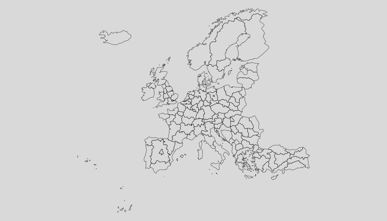
eu_level0 <- loadCoordEU(unit = "nuts2")
mappingEU(eu_level0)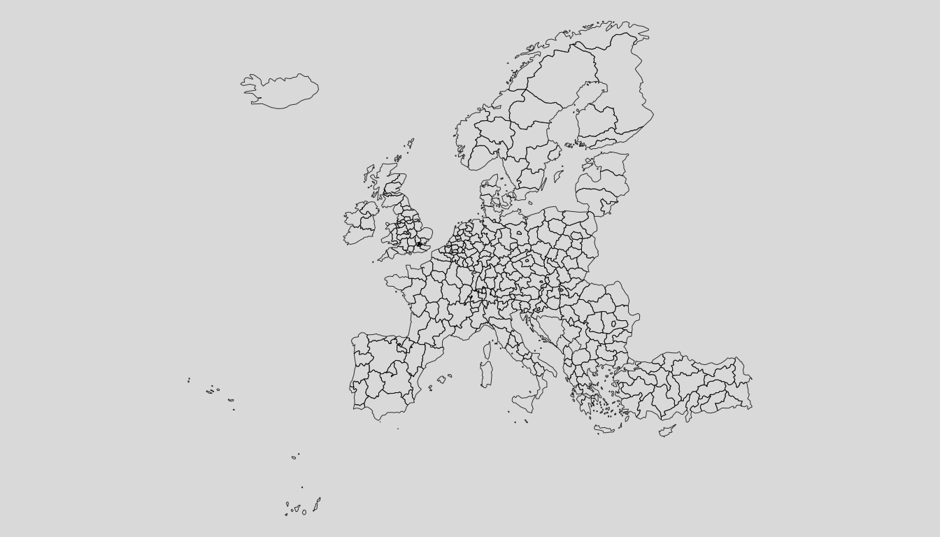
eu_level0 <- loadCoordEU(unit = "nuts3")
mappingEU(eu_level0)