Static maps for World countries
mappingWR.RdFunction to produce static maps for world countries.
Usage
mappingWR(data, var = NULL, colID = NULL,
type = c("static", "interactive"),
typeStatic = c("tmap", "choro.cart",
"typo", "bar"),
unit = c("country", "nato", "ocde", "continent",
"region", "subregion", "region_wb",
"type_income", "type_economy"),
matchWith = c("country", "iso2", "iso3",
"iso3_eh", "iso3_numeric",
"iso3_un", "iso2_wb", "iso3_wb",
"name_formal", "name_wb"),
res = c("low", "hi"), dir = NULL, show_wr = TRUE,
add_text = NULL, subset = NULL,
facets = NULL, aggregation_fun = sum, aggregation_unit = NULL,
options = mapping.options(legend.position = c("left", "bottom")))Arguments
- data
a data.frame object with variables to display or a
WRobject produced byWRfunction- var
character value(s) or columns number(s) indicating the variable to plot
- colID
character value or columns number indicating the column with unit names
- type
if generates static or interactive map
- typeStatic
type of static map
- unit
the type of world statistical unit
- matchWith
the type of id to check:
"country"if country names). "iso2"if iso2 code. "iso3"if iso3 code. "iso3_eh"if iso3_eh code. "iso3_numeric"if iso3 numeric code. "iso3_un"if iso3 United Nations. "iso2_wb"if iso2 World Bank. "iso3_wb"if iso3 World Bank. "name_formal"if formal names. "name_wb"if World Bank names. - res
map resolution
- dir
local directory in which shape files are stored
- show_wr
logical value set to TRUE indicating if the map entire map is drawn or only the coordinates linked to the input data
- add_text
character name indicating the column with text labels
- subset
a formula indicating the condition to subset the data. See the details section
- facets
variable(s) name to split the data
- aggregation_fun
function to use when data are aggregated
- aggregation_unit
variable name by which the unit are aggregated
- options
a list with options using
mapping.optionsfunction
Details
If data is a object of class "WR" generated using the WR function, the arguments unit, year, and matchWith are ignored, because the object already contains the coordinates.
The aggregation_unit provides an aggregation for a user specified variable in data, or for larger statistical unit, automatically provided when the function link the data with the coordinates.
subset provide an expression to subsetting the data using a formula, with the logical operators. For example data can be subsetting as follows: ~I("Variable 1" == "condition 1" & "Variable 2" != "condition 2") or for example, ~I("Variable 1" > "condition 1" | "Variable 2" != "condition 2").
References
Giraud, T. and Lambert, N. (2016). cartography: Create and Integrate Maps in your R Workflow. JOSS, 1(4). doi: 10.21105/joss.00054.
Pebesma, E., 2018. Simple Features for R: Standardized Support for Spatial Vector Data. The R Journal 10 (1), 439-446, https://doi.org/10.32614/RJ-2018-009
Tennekes M (2018). “tmap: Thematic Maps in R.” _Journalstatisticaltical Software_, *84*(6), 1-39. doi: 10.18637/jss.v084.i06 (URL: https://doi.org/10.18637/jss.v084.i06).
Examples
data("popWR")
popWR <- popWR
wr <- WR(data = popWR, colID = "country_code",
matchWith = "iso3_eh", check.unit.names = FALSE,
res = "low")
###############
# Statics #
###############
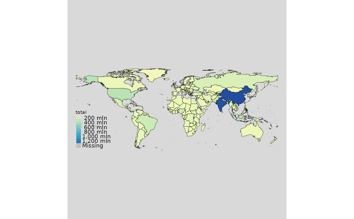
mappingWR(data = wr, var = "total")
 # \donttest{
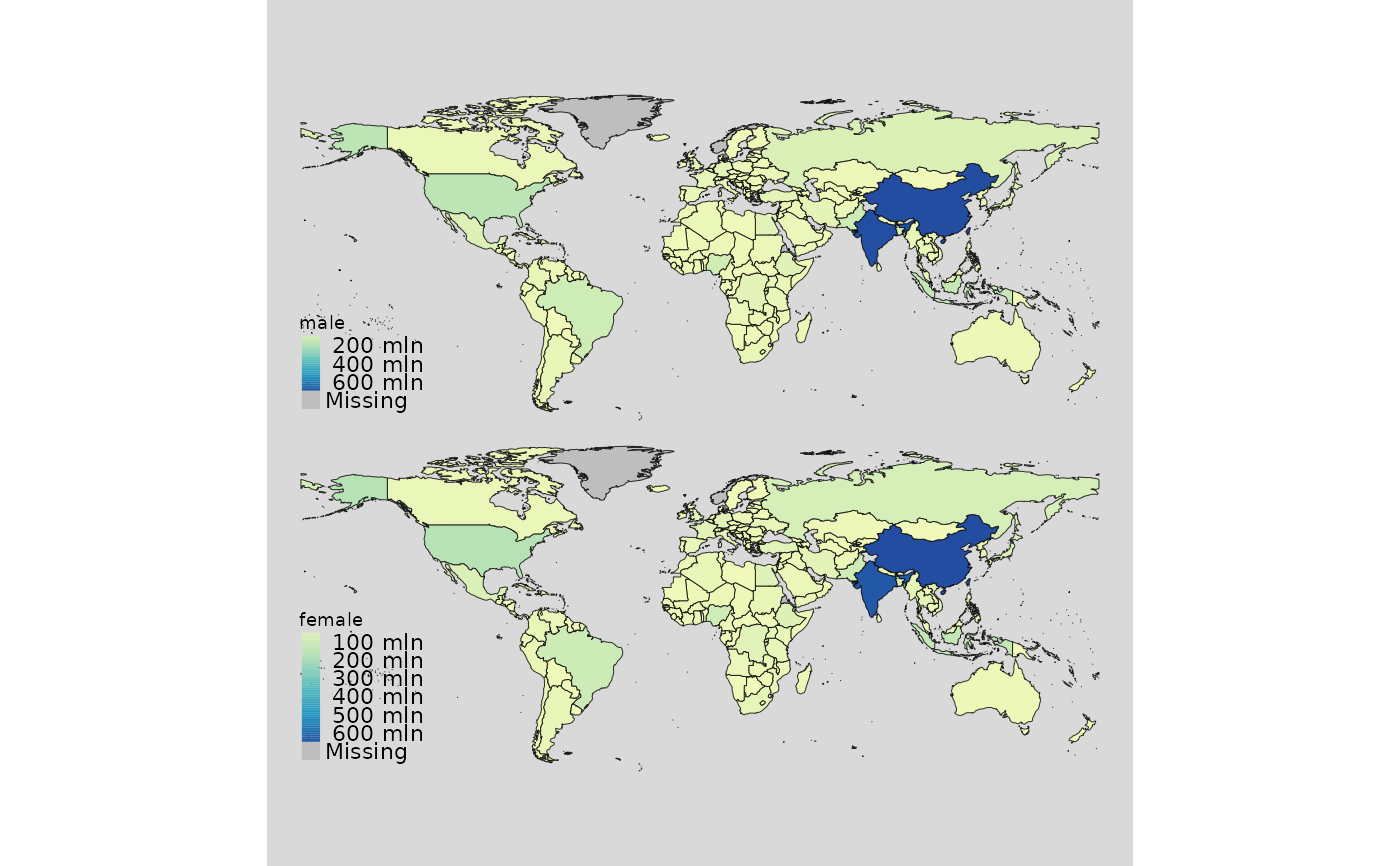
mappingWR(data = wr, var = c("male","female"))
# \donttest{
mappingWR(data = wr, var = c("male","female"))
 mappingWR(data = wr, var = "total", subset = ~I(iso2 == "IT"))
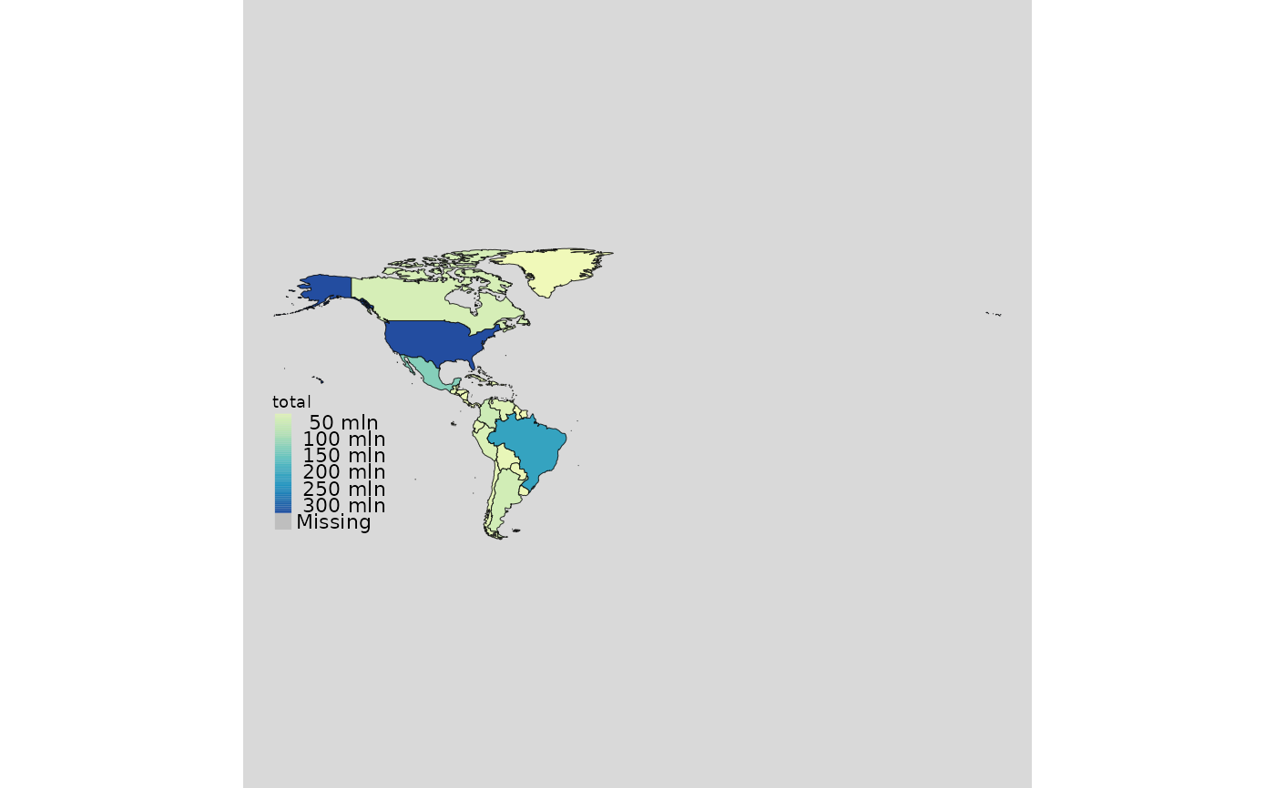
 mappingWR(data = wr, var = "total", subset = ~I(region == "Americas"))
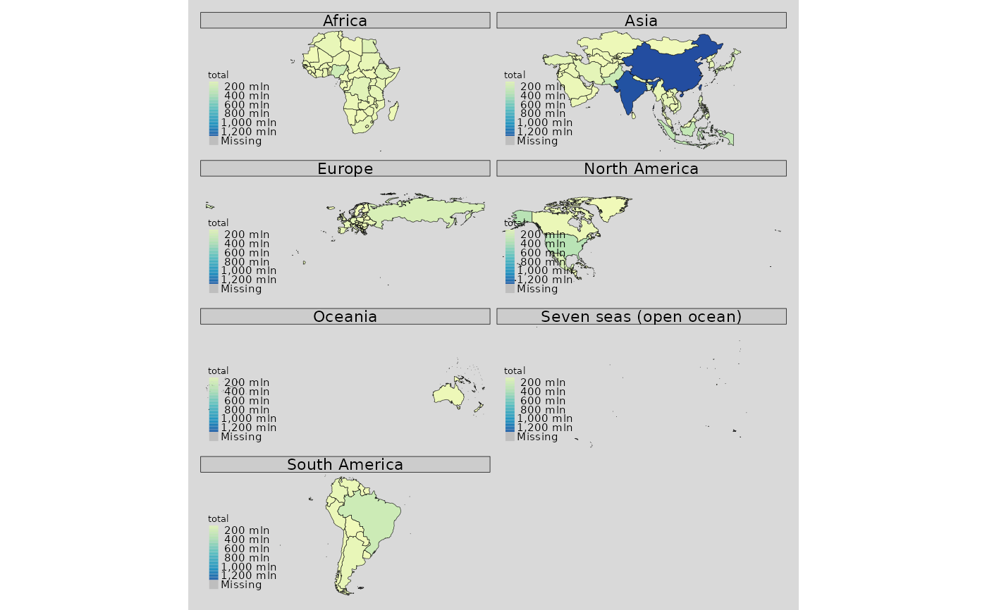
 mappingWR(data = wr, var = "total", facets = "continent")
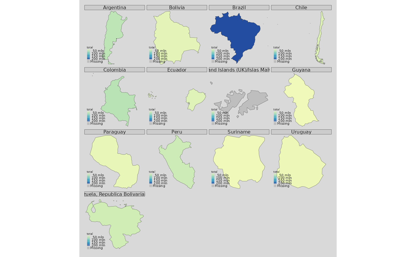
 mappingWR(data = wr, var = "total",
subset = ~I(continent == "South America"),
facets = "name_wb")
mappingWR(data = wr, var = "total",
subset = ~I(continent == "South America"),
facets = "name_wb")
 # }
# \donttest{
mappingWR(data = wr, var = "total", typeStatic = "choro.cart")
# }
# \donttest{
mappingWR(data = wr, var = "total", typeStatic = "choro.cart")
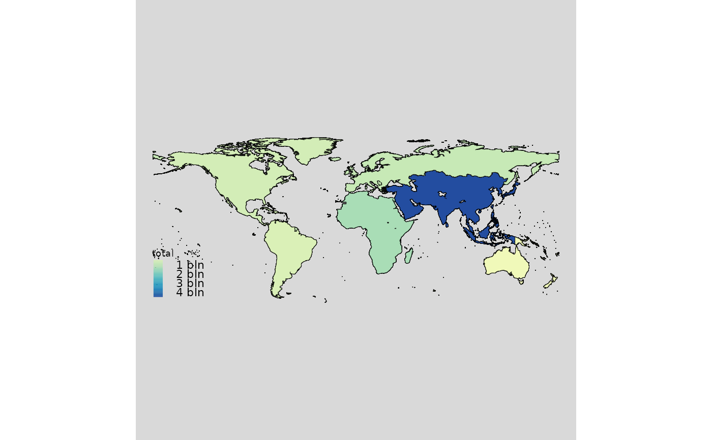
 mappingWR(data = wr, var = "total", aggregation_unit = "continent",
aggregation_fun = function(x) sum(x, na.rm = TRUE))
mappingWR(data = wr, var = "total", aggregation_unit = "continent",
aggregation_fun = function(x) sum(x, na.rm = TRUE))
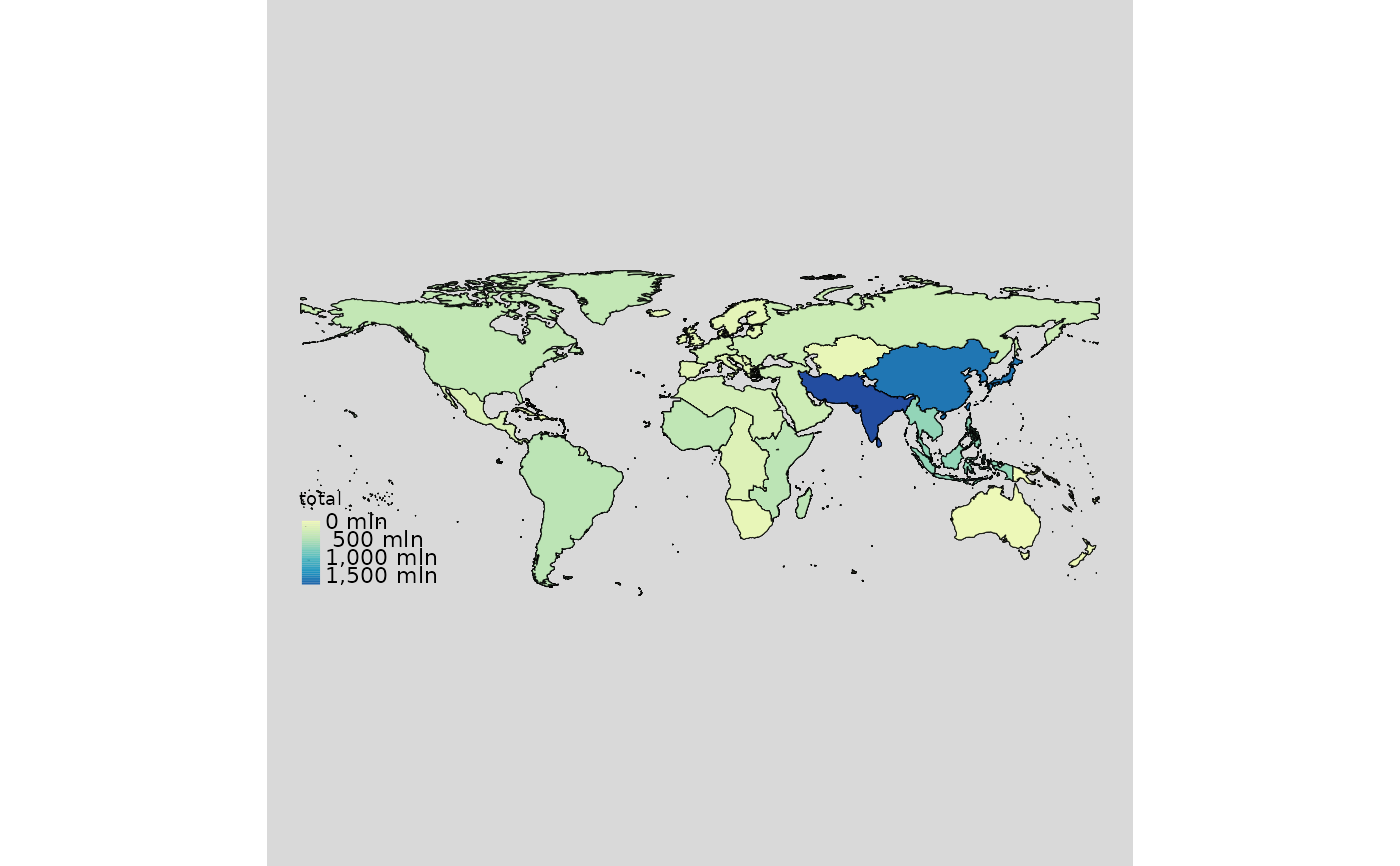
 mappingWR(data = wr, var = "total", aggregation_unit = "subregion",
aggregation_fun = function(x) sum(x, na.rm = TRUE))
mappingWR(data = wr, var = "total", aggregation_unit = "subregion",
aggregation_fun = function(x) sum(x, na.rm = TRUE))
 ## World countries
wr1 <- loadCoordWR()
mappingWR(data = wr1)
## World countries
wr1 <- loadCoordWR()
mappingWR(data = wr1)
 ###############
# Interactive #
###############
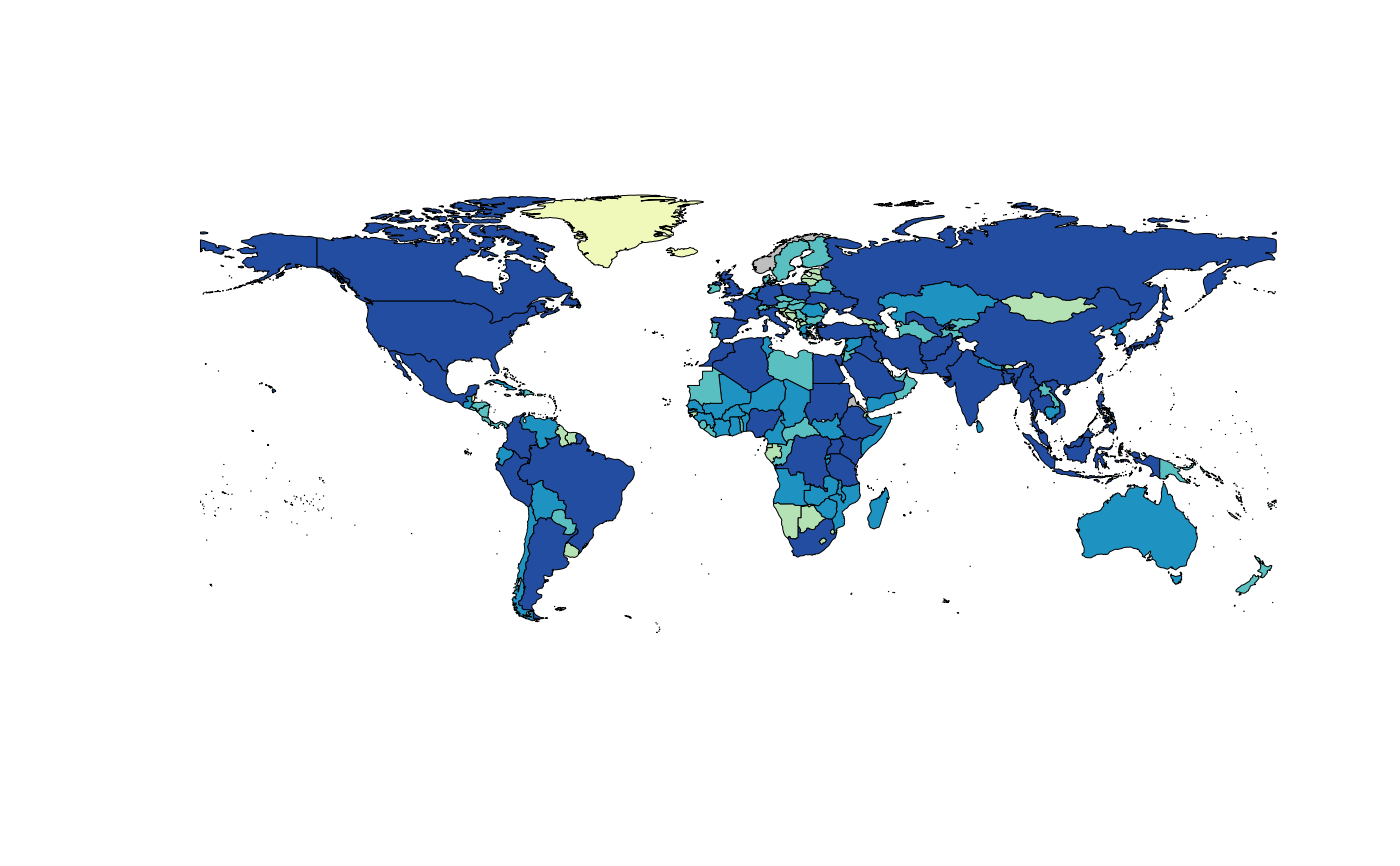
mappingWR(data = wr, var = "total", type = "interactive")
mappingWR(data = wr, var = c("male","female"), type = "interactive")
mappingWR(data = wr, var = "total", subset = ~I(iso2 == "IT"), type = "interactive")
# }
# \donttest{
mappingWR(data = wr, var = "total",
subset = ~I(region == "Americas"), type = "interactive")
mappingWR(data = wr, var = "total", type = "interactive",
aggregation_unit = "continent",
aggregation_fun = function(x) sum(x, na.rm = TRUE))
###############
# Interactive #
###############
mappingWR(data = wr, var = "total", type = "interactive")
mappingWR(data = wr, var = c("male","female"), type = "interactive")
mappingWR(data = wr, var = "total", subset = ~I(iso2 == "IT"), type = "interactive")
# }
# \donttest{
mappingWR(data = wr, var = "total",
subset = ~I(region == "Americas"), type = "interactive")
mappingWR(data = wr, var = "total", type = "interactive",
aggregation_unit = "continent",
aggregation_fun = function(x) sum(x, na.rm = TRUE))